South Dakota Birding Hotspot
Madison Waterfowl Production Area
Lake County
| Click on points to view actual ground photos and birding information for those locations. Use the Google tools to switch between road maps, terrain, or satellite images. |
Directions:
The Madison Waterfowl Production Area is approximately 5 miles southeast of Madison, in Lake County. It is 1 mile south of the intersection of Highway 34 and Highway 19, just on the west side of Lake Madison. From I-29, take Highway 34 west about 20 miles to get to the intersection with Highway 19. From I-90, take Highway 19 north about 30 miles to get to the WPA.
Geographic Coordinates: 43° 58' 3" N, 97° 4' 30" W
Description:
A fairly large, shallow lake sits at the center of the Madison Waterfowl WPA, and is a little over 1 mile in total length. The majority of the lake is extremely shallow, although it must have deeper sections as it does support a large population of carp and perhaps other fish. The shallow edges of the lake are ringed with herbaceous wetland vegetation, which on some parts of the WPA can be quite extensive. Note that water levels in the WPA can fluctuate quite a bit from year to year, which can have a very big impact on the mix of waterfowl, wading birds, and shorebirds that are found at the WPA. The lake and wetlands are set amidst a surrounding landscape of grassland with a few small belts of trees, areas that can also be decent to bird. To view actual photos of the WPA, click on the magenta numbers (1, 2, 3) on the black-and-white aerial photograph shown below.
Lake Madison itself sits just across Highway 19 to the east. In addition to large open water habitat of the lake itself, Lake Madison also has significant areas of shallow water and wetlands, especially in the northwest corner of the lake.
Points of Note:
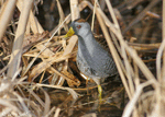
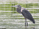
Click on the numbers on the Google Map for actual ground photos for those locations. While Highway 19 does intersect the water body on the eastern edge of the WPA, the best access can be found by use of a gravel access road running along the north edge of the water/wetland (shown in red on the aerial photo below). Note that the road can get muddy and almost impassable after a recent heavy rain, and be careful where the road goes over a culvert, as the road often washes out after heavy rain. While most of the road is at the north edge of the wetland or runs through the upland grasslands surrounding the wetland, it does intersect water and wetland at point "1" (shown below). Good luck can be had just parking at point 1 and waiting for the birds to get used to your presence. After a time, otherwise shy Sora, Virginia Rail, and Green Herons may appear out of the thick vegetation and come into open view, while Great Egrets, Great Blue Herons, gulls, terns, waterfowl, and shorebirds may also be seen from this location depending on the time of year.
Grassland areas along the north side of the access road can sometimes provide good viewing opportunities for typical grassland species, including Bobolinks, an occasional Upland Sandpiper, and grassland sparrow species.
Also note that a gravel road intersections a shallow water and wetland vegetation expanse at the western edge of the WPA, shown at points "2" and "3" on the aerial photo below. Water and wetland vegetation on both sides of the road can offer excellent viewing of waterfowl, wading birds, and shorebirds. This area offers perhaps the best chance to view shorebirds during migration, but only if lower water levels result in areas of very shallow water.
Birds of Note:
The vast expanses of shallow water can make the Madison WPA a nice location for shorebirds in the spring, depending upon water levels. The road running through the west edge of the WPA (near points 2 and 3) offer perhaps the best spring viewing opportunities for shorebirds. Depending on water levels, point 1 may also offer good viewing opportunities.
Spring and late summer/early fall also may offer viewing of large numbers of American White Pelicans, Great Egrets, Green Herons, Great Blue Herons, while an occasional Snowy Egret or Cattle Egret may make an appearance. Very large numbers of Franklin's and Bonaparte's Gulls are sometimes present, while lesser numbers of Common, Forster's, and Black Terns can also be found.
Waterfowl can often be found in huge numbers during the spring and fall, with excellent viewing opportunities available from near points 2 and 3, and even from Highway 19 as it intersects the WPA.
Click on the photos or species names on the bottom of this page for actual bird photos taken within the WPA.
Other Birding Locations (sorted by distance):
- Dakota Nature Park, Brookings (~35 miles)
- Lake Thompson area (~40 miles)
- Wall Lake and Dewey Gevik Nature Area (~40 miles)
- Western Minnehaha County (~40 miles)
- Outdoor Campus in Sioux Falls (~48 miles)
- Big Sioux Recreation Area (~55 miles)
- Good Earth State Park (~60 miles)
- Beaver Creek Nature Area (~60 miles)
- Newton Hills State Park (~80 miles)
- Gavin's Point Dam (~100 miles)
- North Alabama Bend (~100 miles)
- Presho Area (~180 miles)
- Fort Pierre National Grasslands (~195 miles)
- Pierre / Oahe Dam Area (~200 miles)
- LaCreek National Wildlife Refuge (~300 miles)
Bird Photos from the Madison Waterfowl Production Area |
||
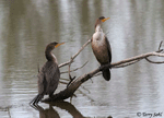 |
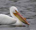 |
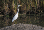 |
| Double-crested Cormorant | American White Pelican | Great Egret |
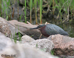 |
 |
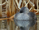 |
| Green Heron | Sora | Pied-billed Grebe |
 |
 |
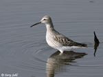 |
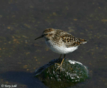
| Great Blue Heron | Least Sandpiper | Stilt Sandpiper |
 |
 |
|
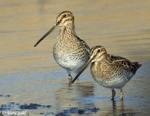
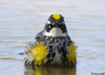
| Wilson's Snipe | Yellow-rumped Warbler | |

